Hi, everyone! I haven't posted in a long time, and that's mostly because I haven't really done anything blog worthy. My Facebook friends have seen that I did some routine hiking and camping my first weekend, saw Lindsey the next weekend (
which she blogged about), went to San Francisco the next week for a conference, went to Gallup the next weekend, and finally had Lindsey visit again (
which she also blogged about). I might put together a blog about my month, since it has been full of travel and fun, but nothing was enough for one blog, I thought.
This blog is going to be about the backpacking trip I took to the San Pedro Parks Wilderness near Cuba, NM.
The turn off to the trail head is located about 16 miles east of Cuba, NM, in the scenic Jemez Ranger District of the Santa Fe National Forest. San Pedro Parks is the only wilderness in the Nacimiento/San Pedro Mountains, and it is named after the many "parks" strewn throughout the wilderness. Park here refers to a wide open grassy area, and you will see many in the following pictures. Our hike started at about 9200 feet and we camped at around 10300 feet, but you would not know from the pictures because this area of the Jemez RD, while high altitude, is relatively flat. The trail starts at a busy parking lot, since this is also the trail head to the scenic San Gregorio Lake, a reservoir that is very popular to local fishermen despite requiring a mile hike uphill to get to.
 |
| San Gregorio Lake |
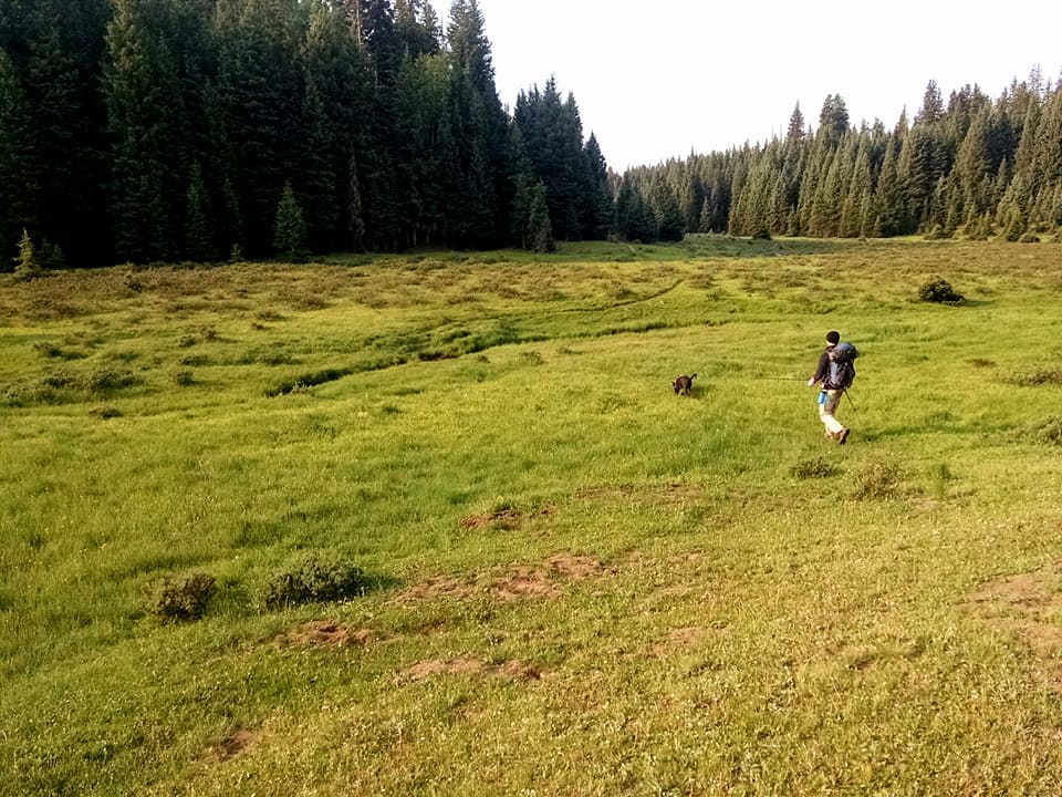
Our trip was about a 7.6 mile hike to our campsite, then another 1.6 miles to the San Pedro Peaks for a round trip of 18.4 miles. The only minor hiccup we had in route finding was that the topo map I printed out via caltopo.com (this website is highly recommended, btw) had trail names that did not correspond with the trail names on the trail. We followed the Vacas Trail (labelled as Clear Creek Trail on the topo) north until we met with the CDT, where we set up camp.
 |
| Some Trail Signs |
Our camp spot was scenic and had several established fire rings. Unfortunately, due to strict, yet necessary (half the state is on fire right now) fire restrictions, we were not able to utilize this convenience. However, our selected spot was nestled among trees, yet not too far from an excellent view of one of the more gorgeous parks on the hike.
 |
| My $30 tent has served me surprisingly well the last 4 years |
|
|
 |
| Trail intersection with the CDT. The mound ahead was where our campsite was. |
 |
| A view from the campsite that doesn't do it justice |
 |
| Sunrise close to camp |
 |
| View of the Rio Vacas going north |
 |
| View of the Rio Vacas going south |
 |
| A different angle of the intersection with the CDT |
We were curious to check out the region labeled on the topo map as "San Pedro Peaks", because we had seen nothing but rolling hills and were eager to see actual mountains. Based on the topo, it was easy to tell they would not be impressive, but nevertheless we found it worthwhile to check out. We had a lot of energy as we were able to make it to our campsite in only about 2.5 hours. Mountain hiking tends to be much slower due to elevation changes, but the relative flatness of this hike kept our pace more than reasonable.
Sure enough, the "San Pedro Peaks" were barely even identifiable. My guess is that the area was so named because a cursory glance across the topo leads me to believe this is the highest point of the wilderness. However, one reward from hiking to this area is that this affords the only view we got of the surrounding mountains, and it is the only spot on the hike you really get an idea of how high up you really are.
 |
| A view from "San Pedro Peaks" |
 |
| The astute among you will recognize this as Pedernal, from Georgia O'Keeffe fame |
We made plans to return here to see the sunrise, but when the alarm went off at 4:30 AM we all internally decided that life in a sleeping bag was better than hiking a mile and a half in 40 degree weather at night.
We made the hike back in great time, doing the entire return in just about 2 hours. We did not see a whole lot of wildlife. Birds were abundant, and the constant songbird chorus during the day added to the idyllic nature of this hike. We saw one deer (and you can, too, if you squint), and plenty of cows.
 |
| Cows are in the distance grazing |
 |
| Deer is in the center |
We could see tracks that appeared to belong to elk and/or deer, and this area is famous for being an elk migration area. One unfortunate source of wildlife was the constant swarm of mosquitoes. In an area as dry and as elevated as NM, mosquitoes are one of the last things you expect to see, but the boy scout troop we passed on the way up told us, "get ready for mosquitoes", and boy, were they right. If it weren't for fire restrictions, a campfire would have gone a long way to keep them away at camp, but they were bad even on the trail. Fortunately they weren't so bad as to ruin the trip, but they were certainly a nuisance.
 |
| I'm pretty sure I lost my sunglasses after falling here. If you find them, they're yours! |
|
This trip was excellent, and as far as backpacking trips go, it was one of my favorites. This area is absolutely beautiful, and while I'd recommend going outside of mosquito season, this unique area in NM will keep you in awe. Camping options are innumerable, and some excellent spots could be found by the creeks. Despite being dangerously close to monsoon season, the weather was nearly perfect, with only a couple ominous looking clouds threatening to spoil the day. After our trip we went into Cuba, NM, hoping to go to the famous El Bruno's, home of the hottest green chile I've ever had. We couldn't wait 40 minutes for them to open, though, so we went to the Cuban Cafe (a restaurant I've been to before), a greasy-spoon diner with eclectic array of decorations. No backpacking trip is complete without engorging yourself on the most unhealthy food you can think of, and I got coffee, chips and salsa, huevos rancheros, and a pancake. I ate all of it.

I hope you enjoyed reading about this trip, and, if you're ever looking to backpack in the Jemez, I would highly recommend San Pedro Parks.
Corrections and notes:
Apparently San Pedro Parks is located within the
Nacimiento Mountains, a range that, to me, is practically indistinguishable from the Jemez Mountains (indeed, if you were driving through you'd have no idea that you were entering a different range). My guess is that the difference comes from the mountains' origins. The Jemez Mountains were formed by intense volcanic activity, whereas the Nacimiento Mountains are part of the southwestern tip of the Rocky Mountains, indicating that they were formed by a geological rift. The distinction is practically nonexistent, but I thought it would be good to set the record straight.
There are actually 3 wildernesses in the Jemez RD by my count: San Pedro Parks, Dome, and Bandelier.
I have since learned that the San Pedro Parks are one of the wettest places in New Mexico in terms of yearly precipitation, which likely accounts for the moisture and mosquitoes.


The pictures are gorgeous and probably don't do the real thing justice. I'm glad you had fun!
ReplyDeleteI had no idea there were places in the Jemez higher than Los Alamos
ReplyDelete