Linville Gorge Wilderness - Trip Report

They Say, "Every Mile in the Gorge Feels Like Two" . . . They're Right

The "Grand Canyon of the West".  Those who take the plunge into the canyon call themselves "Gorge Rats".  Hikers at the Linville Gorge Wilderness are instantly greeted with a sign bluntly displaying the statistic that the Gorge leads the state in yearly wilderness rescues.  I can see why.


History

The Linville Gorge Wilderness in the Pisgah National Forest is the third largest wilderness in North Carolina and one of only two gorge wildernesses in the Southern US.  The Gorge is one of the few examples of old growth forest in the Blue Ridge Mountains, since it's challenging terrain made it unappealing for logging.  The Gorge became protected in 1952 when the land was purchased with funds donated by John D. Rockefeller, and it has been a wilderness area since 1964.  Today it remains the only wilderness gorge with no roads at the bottom and no man-made structures within its boundaries.

Nowadays the Linville Gorge has a devoted fan base (check out the Linville Gorge forum), and it is undoubtedly one of the hardest areas to hike in NC.  The rim is punctuated by steep inclines and exposed mountaintops.  The bottom is known for the snail pace it imposes on hikers.  I can say that, despite the challenge of the Linville Gorge, this is easily the most beautiful place I've been to in NC.


Trip Report

Day 0

We pulled into the Wolf Pit parking lot just north of Morganton, NC, (roughly 3.5 hours from Raleigh) at 11:00 PM on a Thursday night intending to do the Linville Gorge Wilderness Loop (aka the "Is That All You Got?" loop when starting from the Spence Ridge TH).  Our plan was to night hike the first 2 miles to a campsite on Shortoff Mountain and set up camp, but Mother Nature had different plans.  Snow, 30+ mph winds, and a single digit F windchill turned us around after about a mile on the trail, and we slept in the Jeep that night in the Wolf Pit parking lot...

Day 1

After a night of cramped, cold sleep, we took off for Shortoff Mountain (for real this time!).  After only 20 minutes of climbing we were greeted with fantastic views of Lake James State Park to the south.


Lake James State Park

Still bitterly cold and windy, we crossed frozen springs and very odd crystallized ice structures the whole way up to Shortoff Mountain.  All the while we did the cold weather hiking dance.  This is a game you play where you constantly remove and add layers while hiking in cold weather because you are either too hot and start sweating, or you are too cold because you were previously sweating.  The second you stop to take off a layer, your body is no longer working so you cool off and want to put whatever you just took off back on again.  This basically happens non-stop until you go crazy and decide to just be cold.


Frozen spring


Hiking up to Shortoff


Looking out on the way up to Shortoff


Another frozen spring


Crystallized ice structures
Then, we summitted Shortoff Mountain, and I saw the view that told me Linville Gorge was a place like no other I've seen in NC.  From these pictures you can see that the Linville Gorge Wilderness has struggled a bit in the past with forest fires, including one that happened just last summer while I was in Los Alamos.  Speaking of which, the burned-out terrain and mesa-like canyon walls actually did remind me a lot of the Los Alamos landscape.


Looking North towards the Gorge
Looking West towards the Appalachians

From here we could see deep into the Gorge (over 1,200' elevation difference between the rim and canyon bottom) and famous Linville peaks like Tablerock Mountain (center-right foreground) and Hawksbill Mountain (center-right background).  From here they looked so close, but they were oh-so far...   We also saw snow-capped mountains to the West in the direction of Mt. Mitchell, the highest mountain east of the Mississippi.


Panorama at Shortoff
Once we got our fill of the magnificent views on Shortoff Mountain, we had to make the descent to Chimney Gap where we planned to fill our water bottles.  The rim of the Linville Gorge knows how to tantalize hikers with awesome (in the truest sense of the word), jaw-dropping views while torturing them with steep drops and climbs.


Looking east from Chimney Gap


Water source at Chimney Gap


Hiking up to Tablerock from Chimney Gap

After resting at Chimney Gap we had to begin the ascent to Tablerock, one of the most popular areas of the Gorge.  On the way to the Tablerock parking lot you must pass "the Chimneys", an area famous for its rock climbing opportunities.  This is the most exposed portion of the hike, and in some parts you are flanked with steep drops on either side.  There is a reason why this area sees the most rescue missions of any area in NC...  Note that in all pictures the sense of scale is almost completely lost, and the distance and size of the features pictured are all farther and larger than they appear.


Looking back at the trail on the way up to the Chimneys


Looking towards the Chimneys


Looking towards Tablerock near the Chimney summit


After safely navigating the Chimneys, which in high wind felt somewhat dangerous at times, we were on the way to the Tablerock parking lot.  From 1/1 to 3/31 the Tablerock parking lot is closed to cars, but some hikers still hike up the mile-long road to make their way to the summit.


Walking into the Tablerock parking lot


Looking back towards the Chimneys

At this point we were completely beat.  Summitting Tablerock only requires about an extra mile of hiking, but we did not have it in us.  We instead decided to move on to the Spence Ridge trail where we would cross the Linville River and hike south through the Gorge the following day.  From Tablerock, the quickest route is the "Little Tablerock Trail", which is one of the most strenuous trails I've ever been on.  At times the incline felt like it was 45 degrees, and it was incredibly muddy.  By the end my knees were shaking with pain, and as I am writing this two days later my knees are still sore to no end.


Another frozen spring


Tablerock from the Little Tablerock summit


Looking south into the Gorge from the Little Tablerock summit


Hawksbill Mountain from the Little Tablerock trail

We met up with the Spence Ridge trail and headed down to the river.  At one point there was a footbridge at this location, but it has been gone for quite some time.  Nevertheless, various sources have claimed that the river is fordable between 100 and 200 cfs, and it is possible to rock-hop below 100 cfs.  On the morning of this hike I had service and checked the flow rate, which showed 120 cfs.  However, I don't see how one could safely cross the river at this flow.  No rocks were close enough together to leap across without having a serious risk of injury, and from several vantage points we were not able to spot anywhere that looked like wading depth.  Unfortunately, this meant our plans had to change...


Looking south from the destroyed Spence footbridge.  Once again, the photo doesn't do the scale of the rocks justice.
Day 2

We camped up trail at the Waterfall Campsite, whose nearby stream generated a calming white noise all night long.  While this night was not as cold and certainly not as windy as the previous night, I still found myself shivering a bit in my pack at 4:00 AM.  Hot coffee, "trail bangers and mash" (Beef sticks + Idahoan instant mashed potatoes), and a cigar warmed me up in a jiffy.

"Waterfall" at the campsite


Walking back up the Spence Ridge trail
 
At this point we had to make a game plan.  A badly rolled ankle and an incident involving the accidental discharge of a can of bear spray meant that we definitely wouldn't be adding any miles to our hike.  Unfortunately, our previous day's route was the most direct route back to the car, so we decided we would try to hike back in one day but camp overnight at Chimney Gap if that were not possible.


Working back up to the Tablerock parking lot

Though today was far more overcast than the previous day, the wind had died down tremendously, and the temperature was warm enough to go shirtless at times.  We slowly worked our way back up the Little Tablerock trail to the Tablerock parking lot.  Here we got lucky.  Normally the Tablerock parking lot is closed during this time, but a volunteer group had shown up to rebuild fire pits near the picnic area, and we were able to arrange a ride back to the car for my injured hiking partner.  However, I decided to hike back alone to the car.  Because I returned on the exact same route, the hike was obviously very similar to the previous day's, though my perspective was more focused on the views to the South rather than the North just because of my direction of travel.  However, I saw far more groups of hikers, likely due to a combination of the weather and that it was a Saturday.


Looking down into Chimney Gap from the chimneys.  Look carefully to follow the trail down and back up to Shortoff.

I stopped for a water break at Chimney Gap and ate a lunch of tuna and crackers.  I want to take the opportunity to endorse Starkist's "Tuna Creations" flavored tuna packets.  These things are amazing on the trail, and so far Thai Chili and Hot Buffalo Style have both been delicious.  I am looking forward to trying both barbecue styles and the Sriracha style.


Working my way down Shortoff


Back at the trailhead


One last look at Lake James

I made it to the car with time to spare before I was reunited with my hiking partner.  We drove back to Raleigh, stopping at Judge's in Morganton for BBQ and Foothills in Winston-Salem for beer.


"The Judge"


Conclusion

I have to admit that I was underestimating the Gorge.  I have blisters in places I've never had before.  My forearms hurt from using my trekking poles to keep myself stable.  My ankles and knees are quietly begging me to be a couch potato for the next week or so.  I expected that inside the Gorge would be slow because of downed trees, though I didn't get to confirm that theory, but I didn't expect that the rim would be so tough.  While I knew there would be elevation gain, I figured that I had done enough mountain hiking in NM to handle it, but there is definitely truth to the adage that "every mile in the Gorge feels like two".  Apparently, doing the full 11 miles in one day is a commendable feat, and while I don't like to toot my own horn, it certainly felt like it.  In the future I would start at the Spence Ridge TH and go south, since I believe that going North-to-South was much easier than going South-to-North, and the trail volunteers agreed with me.  Overall, though I didn't get to enter the Gorge for more than the brief time we considered crossing the river, I thought the hike was unbelievable.  If weather treats you right (we got unlucky the first two days), there are a ton of desirable camping spots on the rim, and our trip was only cut a tad short because of injury and slightly foreboding weather.  Additionally, if you'll allow me to take a subtle sour grapes jab, I've heard from others who have hiked at the Gorge that the scenery of hiking on the rim far exceeds that of hiking near the river, mostly because there aren't any views except canyon walls at the river.  I think as long as I live in NC the Gorge will be on my radar, since it is one of the closest mountain hikes to Raleigh.


Me at the rim


Looking down at the river and Lake James


Frozen-over pond on Shortoff Mountain
Additional Notes

Evidently the 100-200 cfs range is for the river crossing at the southern end, where the river is wider and much less rocky.  The old Spence Bridge crossing is always a rock-hop, but over 100 cfs it becomes more difficult and highly dependent on one's agility and pack weight.

Neusiok Trail - Trip Report

The Neusiok Trail or: How I Learned to Stop Worrying and Love the Mud

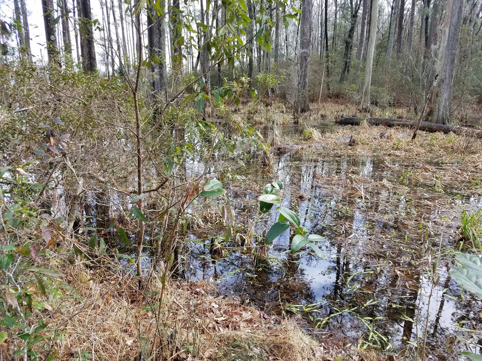
Somewhere far away from the mountains of western NC is a trail that starts and ends at a beach and traverses 21.7 miles of pocosin, savanna, and forest.  Along the way there are three trail shelters and what must be at least 2 miles of boardwalks, which, by the way, still is not enough.  This trail is the Neusiok Trail.

Pine Cliff Trailhead


History

The Neusiok Trail, presumably named for the Neuse River on the northern terminus, was created in the early 70's by the Carteret County Wildlife Club (CCWC) on Croatan National Forest land.  Evidently, in these days the red tape was not so thick, as the USFS had apparently few qualms about a private club hacking away at brush with machetes to create a trail.  I was informed that this is not the case today, and several attempts to reroute the current Neusiok Trail or create new trails throughout the forest have been met with heavy resistance by the North Carolina office of the USFS.

The CCWC, in addition to blazing the Neusiok Trail, also established signage, built and maintains three backcountry shelters with water pumps, and keeps local BSA troops busy building and repairing boardwalks to cover some of the marshiest parts of the trail.  Nowadays, the Neusiok Trail is considered part of the NC Mountains-to-Sea Trail (MST), which stretches from the Appalachian Mountains in the west to the Outer Banks in the east.  Hiking the Neusiok Trail gives a strong sense of community.  Every major trailhead has a MST sign-in sheet, and backcountry shelters have trail logs spanning the past 2 years of Neusiok Trail hikers.  There is a website for the trail that has every iota of information you would ever desire, including contacts for arranging a shuttle, a trail forum, and a "hikers hall of fame" for people who have done the whole trail.  Overall, this is a well-loved trail, and if you find yourself doing all or part of the Neusiok Trail, please remember that there are people who devote a lot of their personal time and money to keep it pretty.


Trip Report

Day 1

Sunrise after a rainy evening at the Oyster Point CG

The three of us left on a Friday afternoon from Raleigh heading east on Highway 70 toward New Bern.  If you are doing the whole trail like we were, consider caching supplies at the trail intersection with NC-101, as this is the approximate halfway point from trailhead-to-trailhead.  It is also only 3/4-mile from the Dogwood Camp shelter.  We cached two bundles of wood wrapped in plastic to ensure we had a store of dry firewood for our evening at Dogwood Camp.  If driving a longer distance like we were (about 2.5 hours), I would recommend camping at the Oyster Point Campground on the southern terminus of the trail and taking a shuttle from Oyster Point to the Pine Cliffs Recreation Area (PCRA) in the morning.  This is advantageous for two reasons: there are no car camping options near the PCRA, and the muddy portion of the hike is delayed until the last possible moment, meaning you won't have to hike 14+ miles with muddy shoes.

Rainbow at the Pine Cliff RA

The first mile or so of the Neusiok Trail skirts the southern bank of the Neuse River right before it feeds into the Pamlico Sound at a point where it's so wide it looks like it could be a large lake.  Here you hike among pine trees, occasionally walking on soft white sand while hearing the sounds of seagulls and water lapping up against the beach, accompanied by a slightly fishy smell to politely yet firmly remind you that you are nearly on North Carolina's coast.  About half a mile in you make the "climb" to the top of a white sand cliff which affords the best vantage point of this beach section of the hike.  Around here there is a picnic table, offering a good place to stop, tighten those straps you forgot to adjust, and empty the sand from your shoes.

Looking north on the sand cliffs

Looking south on the sand cliffs

From here the trail heads south into the forest bordering the eastern bank of Cahoogue Creek for a little over 2 miles before coming to the Copperhead Landing shelter.  It is along this stretch of trail that the boardwalks begin, though they are short compared to the ones that are encountered later.  These boardwalks, most of which are credited to some presumably local Boy Scout troop, are absolutely vital during much of the marshy hike.  However, after a rain one must be careful, since these boardwalks can get extremely slippery, and in some sections a hiker is three feet off the ground with downfall and mud beneath, which could lead to an unfortunate injury in the case of a fall.  Do not forget to fill out the trail log at the Copperhead Landing shelter and take the time to read what others have written!
Trail signage right after leaving the sand cliffs area


First sign of marshland after turning south

One of the first boardwalks on the hike

More marsh

From here the trail continues through peaceful woods until reaching the intersection with Hwy 306.  This first third of the hike is undoubtedly the most crowded, but the scenery is best and the terrain is most forgiving, making it my favorite part of the hike.

View from Copperhead Landing

View of Cahoogue Creek

Marsh just after nearing Cahoogue Creek

Sign at Hwy 306 intersection

After crossing Hwy 306, we continued south onto Hwy 101.  This section has the most boardwalks by far, and according to the Neusok Trail website, the longest section of continuous boardwalk is 0.25 miles.  While I appreciated the boardwalks then, knowing what I know now about the second half of the trail makes me even more thankful.  Along this way we encountered a few hikers, among them a man filming an indiscriminate part of forest and drinking a Modelo tall boy (at 11 AM), with no camp or gear in sight.  We also came across a group of dejected Boy Scouts who had come in late to the Oyster Point campground the night before and apparently were hiking the entire trail in one day.  Later, upon reading their entry in the trail log we learned that the trip chaperone was, understandably, fearing mutiny.  After connecting with Hwy 101 we grabbed our two bundles of wood and hiked the last 0.75 miles to the Dogwood Camp shelter.  We were especially happy upon arriving to camp that someone had left plenty of firewood, thus ensuring we would have a fire as long as we were awake.  That night we told ghost stories while I ate a terrible meal of dehydrated Thai Noodles (I failed to follow directions) and drank two much, much less terrible (i.e., delicious) Troegs Brewing Nugget Nectar Imperial Amber Ales.  I fell asleep to the sound of owls after reading about one page of my book (Thoreau's "Walking").

Dogwood Camp shelter

Evening campfire


Here I should mention that the shelters along the Neusiok Trail are a great luxury.  The shelters are really only big enough to keep your gear dry and off the ground, but they could be used to keep you dry overnight in a bad storm.  They each have a fire pit and a fire grill, plus logs to sit on and a shovel for digging catholes.  Also, they have the only water source on the trail in the form of hand-powered pumps (which must be primed, easy to do).  Though this is a marshy, thus very wet, trail, most of the water is exceedingly muddy, dark, or from a river that is downstream from places I would not want want to drink waste water from.  An added bonus of the shelters are the trail logs, which give a sore hiker a lot to read after setting up camp and having a fire going.  We were particularly amused by one entry, and we spent the better part of the following day's hike trying to imagine what its enigmatic authors "Luigi and Fat Dan" were like.


Day 2

The next day we woke up and briskly put away camp, wanting to get home at a reasonable time.  I do not like freeze dried coffee very much, and would honestly rather drink cowboy coffee (grounds directly in the water) than that nasty stuff that comes out of the plastic tubes.  However, I decided to give the Cafe Bustelo instant Cafe con Leche and Cafe con Chocolate a try.  While these are about three times bigger than your standard freeze dried coffee, I found that they were actually pretty good and a nice sweet treat in the morning.

Back on trail after leaving Dogwood Camp


Idyllic stream near boardwalks early into Day 2's hike


The first 2.5-ish miles from Dogwood Camp meander through a peaceful section of forest.  We were treated to warm weather overnight which made for a very pleasant morning hiking.  After this section, you will come upon a forest road, evidently used for logging.  I have mixed feelings about this portion of the hike.  This is a very ugly section; there are trash (including a boat) and shotgun shells everywhere, but I did appreciate the dry and hard-packed terrain, especially knowing what was to come in the very next section.

Turnoff before getting on the forest road; 8.7 muddy miles to go...

The section after getting off the logging road and before crossing Alligator Tram Road is some of the least fun I've ever had hiking.  It starts off with a little mud here or there, nothing terribly worse than we had seen previously, but slowly the mud gets wider and wider.  You start to get closer and closer to the brush to avoid getting muddy, and your pace gets slower and slower as you carefully step and leap to avoid sinking into knee-high mud.  Eventually, after your arm or leg (luckily only a sock for me) has been torn up by thorny brush, you will give up and plop feet first into the mud.  Take my advice; when you arrive here just accept the mud and go straight in.  Your pace will be faster, and you won't injure yourself by jumping around or getting cut by thorns all in service of delaying the inevitable.  Thankfully, after you hit Alligator Tram Road things get much drier.  From here we continued on to the Blackjack Lodge shelter, which, in addition to its water pump being out of commission, had certainly seen better days.  Whoever decided to use the shelter last had left it an absolute mess, evidently thinking that the bucket used to prevent excessive pump spillage was a trash can.  PSA: there are a lot easier and better places to drink a lot of beer and leave trash.  Try behind a Walmart, or a cheap hotel room.

The mess that was Blackjack Lodge

From Blackjack Lodge the trail crosses Mill Creek Road and creeps by marshy meadows to Oyster Point.  This section of the trail is surprisingly scenic and gives glimpses of the Newport River, which has more or less reached the Atlantic Ocean at this point.  Upon reaching Oyster Point we were greeted with the odor of sea creatures and a pile of empty oyster shells before walking the extra 100 yards back to the car, though not before we were passed by a group of trail runners who had just done our two day hike in a matter of hours.  Talk about an ego boost!  We ate our pain away at McCall's Bar-B-Q and Seafood in Goldsboro, NC, which, unfortunately for them but fortunate for us, is a buffet style restaurant with delicious fried chicken and NC style BBQ pork and chicken.  I would also recommend the ribs and fried pork rind.  I washed it down with an ice cold Mountain Dew.

The pleasant view during the last couple miles

Oyster Point Trailhead

My plate at McCall's; don't worry, I ate it all


Conclusion

Our same group did the northern half of the Neusiok Trail last April, which I credit to renewing my interest in backpacking.  I would consider this the second closest worthwhile backpacking destination to the Triangle (the first being Uwharrie) at 2.5 hours driving distance away, and its proximity to the coast and low elevation means it will be doable, in fact preferable, in winter when the mountains are probably a little too chilly for us 3-seasoners.  However, I don't anticipate going back in the near future, as the trail is rather one-note, and the most visually pleasing portions are at the very beginning and very end.  The mud and thorns portion plus the long stretch of dismal forest road make the southern half not worthwhile in my opinion except to claim "I did it" status on the entire trail.  There are no other long distance trails in the area as of now, so there is no way to extend this hike beyond the distance of the actual trail.  Nevertheless, I would recommend doing this trail at least once to anyone in central NC that likes backpacking, and, if I lived in eastern NC where long distance hiking options are slim, I would be grateful to have this trail close to me.  The coastal ecosystem is uncommon in a backpacking context, and there is a chance, though very slim, that you may see an alligator on your hike, so there's that.  Also, the long stretch of boardwalks is a unique backcountry experience, and the trail shelters and trail logs give a thru-hike vibe that I had never experienced before.  Plus, sometimes it's just fun to go with your friends and walk a few miles in the woods, cook over a campfire, drink beer, and sleep on the ground all night.  As far as difficulty goes, this trail is easy, but slippery boardwalks, sand, and mud can slow your pace considerably.

 
Video from Oyster Point beach, I apologize for wind noise

Uwharrie National Forest

Hello, everyone.  As you may have noticed, my posting has stalled since I came back to NC.  I guess I probably owe you an explanation, since I said I was going to make an effort to explore the areas around Raleigh, and I want to make the case that I did.

In September I went on a two-supposed-to-be-three-day trip to Shenandoah National Park in western VA.  One of the most famous national parks east of the Mississippi and renowned for comprising part of the Appalachian Trail (AT), Shenandoah is famous for its views and Skyline Drive, which traverses the park.  We spent the first night at a campground and intended on doing the 13-mile Mount Marshall Loop, split by an overnight stop.  However, the weather forecast, originally projected as sunny and temperate, drastically turned thanks to Hurricane Harvey remnants coming up from Texas.  Unfortunately the rain was accompanied by thick fog, which, while adding a haunting, mystical aura to the prehistoric forest, eliminated all potential views we had driven over 4 hours to see.  Soaked and cold, we finished our hike in 1 day and went back home.

I would love to visit Shenandoah again, hopefully before the potential fee hike from $20 to $70, but I would do a longer trail.  Because of the rain and shortened trip there wasn't enough for me to say about the hike to warrant a separate blog post, but I hope the pictures convey the feelings I had about Shenandoah: as if you were transported back in time 70 million years.

Appalachian Trail marker


In October I missed out on a trip to Linville Gorge, which I heard was quite eventful, because of a neck injury from flag football and because I'm writing my MS thesis.

So here I am in November, over 3 months since my last successful trip with the hiking season winding down.  Even in Raleigh the cold weather is starting to set in, though we haven't gotten any snow, and although the trees are almost bare there are enough colored leaves to remind one that it's fall.  Desperate to squeeze in one last hike, I started reaching out to friends about hiking the nearby Uwharrie National Forest.  Not a large national forest, the Uwharrie is near the small town of Troy, NC, about an hour and a half from the Triangle. The Uwharrie Mountains are remnants of an ancient mountain range that once reached over 20,000' in elevation, but now the highest mountain in the range is a paltry 1,188'.  As a result, there are no crags or sweeping vistas in the Uwharrie; however, the rolling elevation keeps the otherwise simple hike interesting.  We started the first night by staying at the Yates Place Camp in the Southeastern portion of the forest.  This campground is free dispersed camping.  You can set up anywhere you want, but only a few sites have a picnic table.  There is a vault toilet, but there is no water source.  As a result, this campsite doesn't see much traffic despite being free, and most people staying when we got there were hunters in elaborate multi-day campsites or pop-up campers (no RV hookups here).

Looking down the power line service road near camp

Seth making a fire

Sunset through the trees in camp

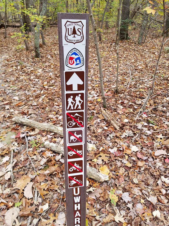
Our trip took us along two of the main trails in this portion of the forest: the Uwharrie National Recreation Trail, built by Eagle Scouts in the 70's, and the Dutchman's Creek Trail.  Both see a decent amount of traffic, but in this cold November weather we saw a dozen or less groups.  These two trails meet at 3 points, making for a popular figure-eight hike that is about 18-21 miles long, depending on who you ask.  However, we had some time constraints for Sunday (more on that later), so we planned to do about 11 miles Day 1 and 4.5 miles Day 2.

All hiking trails are well blazed, and all intersections of hiking trails are well marked


Dutchman's Creek looking a little dry


View atop Lick Mountain


Middle intersection of UNRT and DCT

Dennis Mountain

There were two named "peaks" on this trip, Dennis Mountain and Lick Mountain.  Lick Mountain was particularly strenuous, but relative to authentic mountain hiking it was not hard at all.  Unfortunately there are no clearings or balds in the Uwharrie, so there is nowhere to get a good view when atop a mountain.  While you can catch glimpses through the trees, these do not translate well to pictures.  When we went the creeks were mostly dry, and we ended up having to filter standing water.  While this water looked quite clear and was probably a product of rain from earlier in the week, standing water is not the greatest to drink because of the higher likelihood of parasites and bacteria, and I'm hesitant to drink it even after being filtered.  However, I've not gotten worms to my knowledge, and the water tasted fine.  Regardless, I would not plan on there being water unless you come during the wetter seasons.  Perhaps caching water at one of the trail intersections would be ideal in the future, but we did not consider this.  Were you to repeat our hike, note that the trail intersection we make on the southern tip is not a true intersection.  You have to briefly go off-trail to meet a bike trail and hike north, although the bike trail was really easy to spot and is only about 20 yards from the UNRT trail.

Picturesque early-morning fire


Overall this hike was pleasant.  Being the closest true backpacking destination to Raleigh makes up for the shortcomings in scenery, although even in late fall there were colored leaves on the trees.  Something I've had to get used to in NC that I never really encountered in NM is that backcountry hiking and camping is much more restricted.  Oftentimes you need permits to camp, and fires are restricted year-round, but the Uwharrie is pretty much free of red tape.  This is a beautiful, cozy area with a storied past I'd love to learn more about.  It won't make many Instagram photo albums, but the Uwharrie is a once-a-year destination for anyone living in the Triangle who likes backpacking, especially after colder weather has made the mountains unattractive.  By the way, my time restriction on Sunday was that grabbing BBQ after a trip has become a tradition, and the BBQ place I wanted to go to, Ron's Barn Barbecue & Seafood in Sanford, NC, closed at 2 pm on Sunday.  We made it, and I would highly recommend it to anyone in the area.  It was affordable, and the fried chicken was excellent.  If you do a similar trip and can't make it to Ron's Barn, The Pik 'N Pig in Carthage, NC, is also an excellent BBQ restaurant that is open until 3 pm on Sunday.

Ron's Barn with a line of church-goers out the door

By the way, we also got BBQ on the way back from Shenandoah.  We went to Deep Run Roadhouse near the VCU campus in Richmond, VA.  This place was very good, but watch out for the subtle upsell or you will have an expensive tab.