that starts and ends at a beach and traverses 21.7 miles of pocosin, savanna, and forest. Along the way there are three trail shelters and what must be at least 2 miles of boardwalks, which, by the way, still is not enough. This trail is the Neusiok Trail.
 |
| Pine Cliff Trailhead |
History
The Neusiok Trail, presumably named for the Neuse River on the northern terminus, was created in the early 70's by the Carteret County Wildlife Club (CCWC) on Croatan National Forest land. Evidently, in these days the red tape was not so thick, as the USFS had apparently few qualms about a private club hacking away at brush with machetes to create a trail. I was informed that this is not the case today, and several attempts to reroute the current Neusiok Trail or create new trails throughout the forest have been met with heavy resistance by the North Carolina office of the USFS.
The CCWC, in addition to blazing the Neusiok Trail, also established signage, built and maintains three backcountry shelters with water pumps, and keeps local BSA troops busy building and repairing boardwalks to cover some of the marshiest parts of the trail. Nowadays, the Neusiok Trail is considered part of the NC Mountains-to-Sea Trail (MST), which stretches from the Appalachian Mountains in the west to the Outer Banks in the east. Hiking the Neusiok Trail gives a strong sense of community. Every major trailhead has a MST sign-in sheet, and backcountry shelters have trail logs spanning the past 2 years of Neusiok Trail hikers. There is a
website for the trail that has every iota of information you would ever desire, including contacts for arranging a shuttle, a trail forum, and a "hikers hall of fame" for people who have done the whole trail. Overall, this is a well-loved trail, and if you find yourself doing all or part of the Neusiok Trail, please remember that there are people who devote a lot of their personal time and money to keep it pretty.
Trip Report
Day 1
 |
| Sunrise after a rainy evening at the Oyster Point CG |
The three of us left on a Friday afternoon from Raleigh heading east on Highway 70 toward New Bern. If you are doing the whole trail like we were, consider caching supplies at the trail intersection with NC-101, as this is the approximate halfway point from trailhead-to-trailhead. It is also only 3/4-mile from the Dogwood Camp shelter. We cached two bundles of wood wrapped in plastic to ensure we had a store of dry firewood for our evening at Dogwood Camp. If driving a longer distance like we were (about 2.5 hours), I would recommend camping at the Oyster Point Campground on the southern terminus of the trail and taking a shuttle from Oyster Point to the Pine Cliffs Recreation Area (PCRA) in the morning. This is advantageous for two reasons: there are no car camping options near the PCRA, and the muddy portion of the hike is delayed until the last possible moment, meaning you won't have to hike 14+ miles with muddy shoes.
 |
| Rainbow at the Pine Cliff RA |
The first mile or so of the Neusiok Trail skirts the southern bank of the Neuse River right before it feeds into the Pamlico
Sound at a point where it's so wide it looks like it could be a large
lake. Here you hike among pine trees, occasionally walking on soft white sand while hearing the sounds of seagulls and water lapping up against the beach, accompanied by a slightly fishy smell to politely yet firmly remind you that you are nearly on North Carolina's coast. About half a mile in you make the "climb" to the top of a white sand cliff which affords the best vantage point of this beach section of the hike. Around here there is a picnic table, offering a good place to stop, tighten those straps you forgot to adjust, and empty the sand from your shoes.
 |
| Looking north on the sand cliffs |
 |
| Looking south on the sand cliffs |
From here the trail heads south into the forest bordering the eastern bank of Cahoogue Creek for a little over 2 miles before coming to the Copperhead Landing shelter. It is along this stretch of trail that the boardwalks begin, though they are short compared to the ones that are encountered later. These boardwalks, most of which are credited to some presumably local Boy Scout troop, are absolutely vital during much of the marshy hike. However, after a rain one must be careful, since these boardwalks can get extremely slippery, and in some sections a hiker is three feet off the ground with downfall and mud beneath, which could lead to an unfortunate injury in the case of a fall. Do not forget to fill out the trail log at the Copperhead Landing shelter and take the time to read what others have written!
 |
| Trail signage right after leaving the sand cliffs area |
 |
| First sign of marshland after turning south |
 |
| One of the first boardwalks on the hike |
 |
| More marsh |
From here the trail continues through peaceful woods until reaching the intersection with Hwy 306. This first third of the hike is undoubtedly the most crowded, but the scenery is best and the terrain is most forgiving, making it my favorite part of the hike.
 |
| View from Copperhead Landing |
 |
| View of Cahoogue Creek |
 |
| Marsh just after nearing Cahoogue Creek |
 |
| Sign at Hwy 306 intersection |
After crossing Hwy 306, we continued south onto Hwy 101. This section has the most boardwalks by far, and according to the Neusok Trail website, the longest section of continuous boardwalk is 0.25 miles. While I appreciated the boardwalks then, knowing what I know now about the second half of the trail makes me even more thankful. Along this way we encountered a few hikers, among them a man filming an indiscriminate part of forest and drinking a Modelo tall boy (at 11 AM), with no camp or gear in sight. We also came across a group of dejected Boy Scouts who had come in late to the Oyster Point campground the night before and apparently were hiking the entire trail in one day. Later, upon reading their entry in the trail log we learned that the trip chaperone was, understandably, fearing mutiny. After connecting with Hwy 101 we grabbed our two bundles of wood and hiked the last 0.75 miles to the Dogwood Camp shelter. We were especially happy upon arriving to camp that someone had left plenty of firewood, thus ensuring we would have a fire as long as we were awake. That night we told ghost stories while I ate a terrible meal of dehydrated Thai Noodles (I failed to follow directions) and drank two much, much less terrible (i.e., delicious) Troegs Brewing Nugget Nectar Imperial Amber Ales. I fell asleep to the sound of owls after reading about one page of my book (Thoreau's "Walking").
 |
| Dogwood Camp shelter |
 |
| Evening campfire |
Here I should mention that the shelters along the Neusiok Trail are a great luxury. The shelters are really only big enough to keep your gear dry and off the ground, but they could be used to keep you dry overnight in a bad storm. They each have a fire pit and a fire grill, plus logs to sit on and a shovel for digging catholes. Also, they have the only water source on the trail in the form of hand-powered pumps (which must be primed, easy to do). Though this is a marshy, thus very wet, trail, most of the water is exceedingly muddy, dark, or from a river that is downstream from places I would not want want to drink waste water from. An added bonus of the shelters are the trail logs, which give a sore hiker a lot to read after setting up camp and having a fire going. We were particularly amused by one entry, and we spent the better part of the following day's hike trying to imagine what its enigmatic authors "Luigi and Fat Dan" were like.
Day 2
The next day we woke up and briskly put away camp, wanting to get home at a reasonable time. I do not like freeze dried coffee very much, and would honestly rather drink cowboy coffee (grounds directly in the water) than that nasty stuff that comes out of the plastic tubes. However, I decided to give the Cafe Bustelo instant Cafe con Leche and Cafe con Chocolate a try. While these are about three times bigger than your standard freeze dried coffee, I found that they were actually pretty good and a nice sweet treat in the morning.
 |
| Back on trail after leaving Dogwood Camp |
 |
| Idyllic stream near boardwalks early into Day 2's hike |
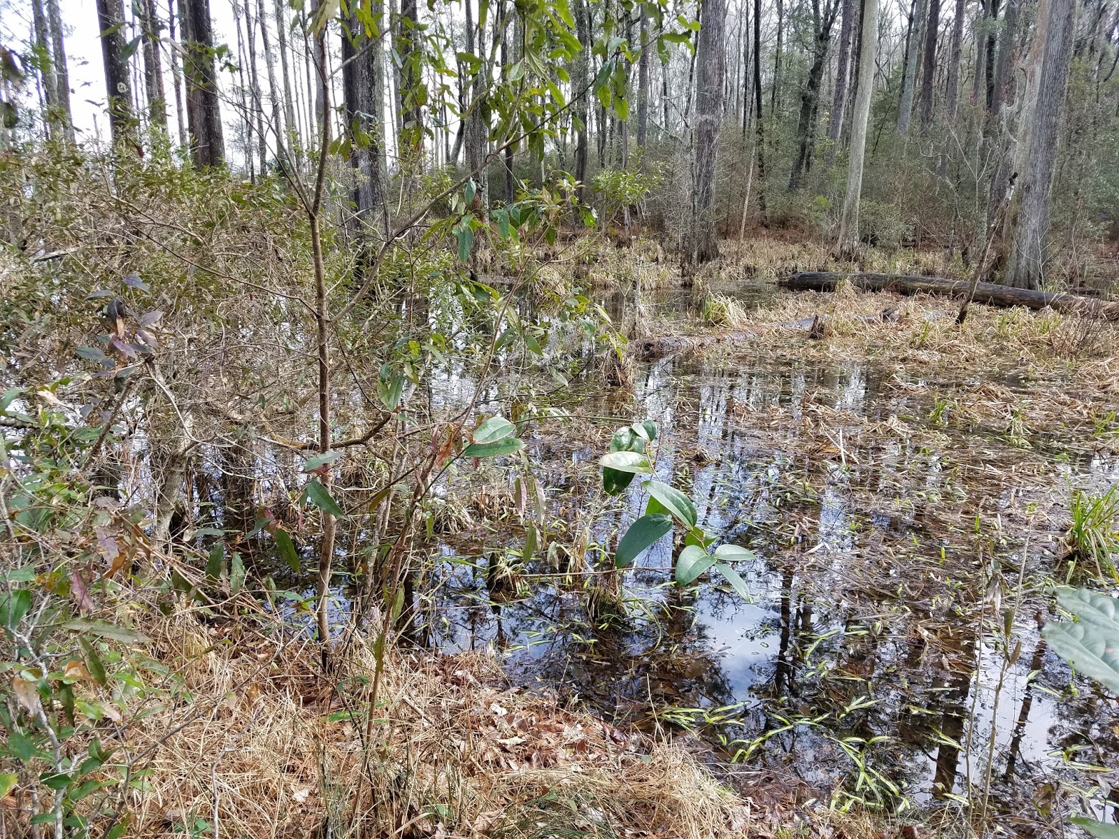
The first 2.5-ish miles from Dogwood Camp meander through a peaceful section of forest. We were treated to warm weather overnight which made for a very pleasant morning hiking. After this section, you will come upon a forest road, evidently used for logging. I have mixed feelings about this portion of the hike. This is a very ugly section; there are trash (including a boat) and shotgun shells everywhere, but I did appreciate the dry and hard-packed terrain, especially knowing what was to come in the very next section.
 |
| Turnoff before getting on the forest road; 8.7 muddy miles to go... |
The section after getting off the logging road and before crossing Alligator Tram Road is some of the least fun I've ever had hiking. It starts off with a little mud here or there, nothing terribly worse than we had seen previously, but slowly the mud gets wider and wider. You start to get closer and closer to the brush to avoid getting muddy, and your pace gets slower and slower as you carefully step and leap to avoid sinking into knee-high mud. Eventually, after your arm or leg (luckily only a sock for me) has been torn up by thorny brush, you will give up and plop feet first into the mud. Take my advice; when you arrive here just accept the mud and go straight in. Your pace will be faster, and you won't injure yourself by jumping around or getting cut by thorns all in service of delaying the inevitable. Thankfully, after you hit Alligator Tram Road things get much drier. From here we continued on to the Blackjack Lodge shelter, which, in addition to its water pump being out of commission, had certainly seen better days. Whoever decided to use the shelter last had left it an absolute mess, evidently thinking that the bucket used to prevent excessive pump spillage was a trash can. PSA: there are a lot easier and better places to drink a lot of beer and leave trash. Try behind a Walmart, or a cheap hotel room.
 |
| The mess that was Blackjack Lodge |
From Blackjack Lodge the trail crosses Mill Creek Road and creeps by marshy meadows to Oyster Point. This section of the trail is surprisingly scenic and gives glimpses of the Newport River, which has more or less reached the Atlantic Ocean at this point. Upon reaching Oyster Point we were greeted with the odor of sea creatures and a pile of empty oyster shells before walking the extra 100 yards back to the car, though not before we were passed by a group of trail runners who had just done our two day hike in a matter of hours. Talk about an ego boost! We ate our pain away at McCall's Bar-B-Q and Seafood in Goldsboro, NC, which, unfortunately for them but fortunate for us, is a buffet style restaurant with delicious fried chicken and NC style BBQ pork and chicken. I would also recommend the ribs and fried pork rind. I washed it down with an ice cold Mountain Dew.
 |
| The pleasant view during the last couple miles |
 |
| Oyster Point Trailhead |
 |
| My plate at McCall's; don't worry, I ate it all |
Conclusion
Our same group did the northern half of the Neusiok Trail last April, which I credit to renewing my interest in backpacking. I would consider this the second closest worthwhile backpacking destination to the Triangle (the first being Uwharrie) at 2.5 hours driving distance away, and its proximity to the coast and low elevation means it will be doable, in fact preferable, in winter when the mountains are probably a little too chilly for us 3-seasoners. However, I don't anticipate going back in the near future, as the trail is rather one-note, and the most visually pleasing portions are at the very beginning and very end. The mud and thorns portion plus the long stretch of dismal forest road make the southern half not worthwhile in my opinion except to claim "I did it" status on the entire trail. There are no other long distance trails in the area as of now, so there is no way to extend this hike beyond the distance of the actual trail. Nevertheless, I would recommend doing this trail at least once to anyone in central NC that likes backpacking, and, if I lived in eastern NC where long distance hiking options are slim, I would be grateful to have this trail close to me. The coastal ecosystem is uncommon in a backpacking context, and there is a chance, though very slim, that you may see an alligator on your hike, so there's that. Also, the long stretch of boardwalks is a unique backcountry experience, and the trail shelters and trail logs give a thru-hike vibe that I had never experienced before. Plus, sometimes it's just fun to go with your friends and walk a few miles in the woods, cook over a campfire, drink beer, and sleep on the ground all night. As far as difficulty goes, this trail is easy, but slippery boardwalks, sand, and mud can slow your pace considerably.
Video from Oyster Point beach, I apologize for wind noise