Uwharrie National Forest

Hello, everyone.  As you may have noticed, my posting has stalled since I came back to NC.  I guess I probably owe you an explanation, since I said I was going to make an effort to explore the areas around Raleigh, and I want to make the case that I did.

In September I went on a two-supposed-to-be-three-day trip to Shenandoah National Park in western VA.  One of the most famous national parks east of the Mississippi and renowned for comprising part of the Appalachian Trail (AT), Shenandoah is famous for its views and Skyline Drive, which traverses the park.  We spent the first night at a campground and intended on doing the 13-mile Mount Marshall Loop, split by an overnight stop.  However, the weather forecast, originally projected as sunny and temperate, drastically turned thanks to Hurricane Harvey remnants coming up from Texas.  Unfortunately the rain was accompanied by thick fog, which, while adding a haunting, mystical aura to the prehistoric forest, eliminated all potential views we had driven over 4 hours to see.  Soaked and cold, we finished our hike in 1 day and went back home.

I would love to visit Shenandoah again, hopefully before the potential fee hike from $20 to $70, but I would do a longer trail.  Because of the rain and shortened trip there wasn't enough for me to say about the hike to warrant a separate blog post, but I hope the pictures convey the feelings I had about Shenandoah: as if you were transported back in time 70 million years.

Appalachian Trail marker


In October I missed out on a trip to Linville Gorge, which I heard was quite eventful, because of a neck injury from flag football and because I'm writing my MS thesis.

So here I am in November, over 3 months since my last successful trip with the hiking season winding down.  Even in Raleigh the cold weather is starting to set in, though we haven't gotten any snow, and although the trees are almost bare there are enough colored leaves to remind one that it's fall.  Desperate to squeeze in one last hike, I started reaching out to friends about hiking the nearby Uwharrie National Forest.  Not a large national forest, the Uwharrie is near the small town of Troy, NC, about an hour and a half from the Triangle. The Uwharrie Mountains are remnants of an ancient mountain range that once reached over 20,000' in elevation, but now the highest mountain in the range is a paltry 1,188'.  As a result, there are no crags or sweeping vistas in the Uwharrie; however, the rolling elevation keeps the otherwise simple hike interesting.  We started the first night by staying at the Yates Place Camp in the Southeastern portion of the forest.  This campground is free dispersed camping.  You can set up anywhere you want, but only a few sites have a picnic table.  There is a vault toilet, but there is no water source.  As a result, this campsite doesn't see much traffic despite being free, and most people staying when we got there were hunters in elaborate multi-day campsites or pop-up campers (no RV hookups here).

Looking down the power line service road near camp

Seth making a fire

Sunset through the trees in camp

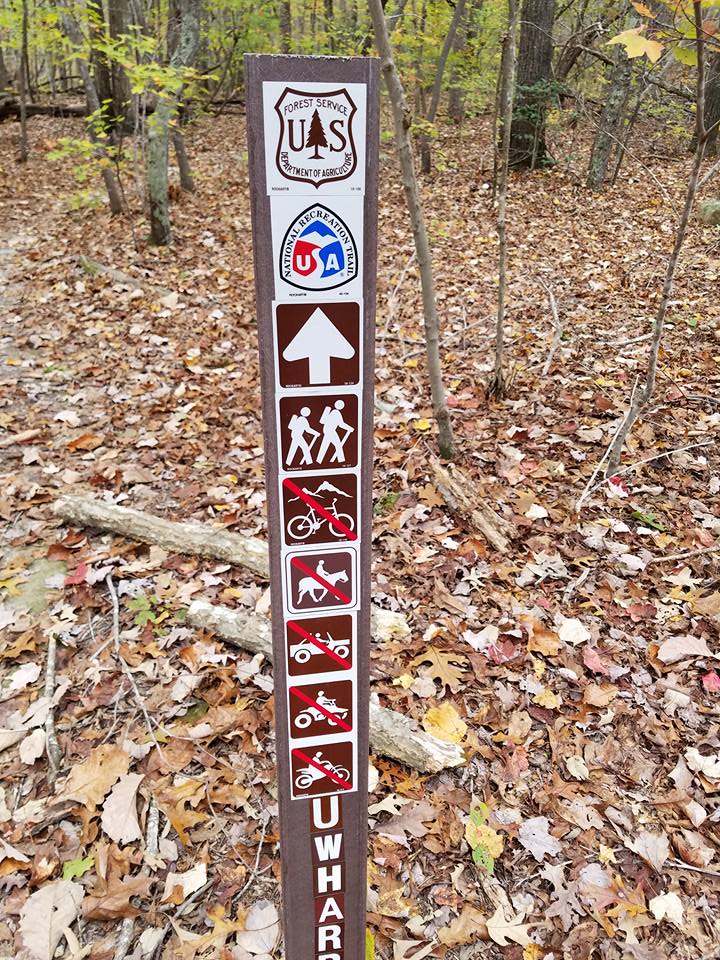
Our trip took us along two of the main trails in this portion of the forest: the Uwharrie National Recreation Trail, built by Eagle Scouts in the 70's, and the Dutchman's Creek Trail.  Both see a decent amount of traffic, but in this cold November weather we saw a dozen or less groups.  These two trails meet at 3 points, making for a popular figure-eight hike that is about 18-21 miles long, depending on who you ask.  However, we had some time constraints for Sunday (more on that later), so we planned to do about 11 miles Day 1 and 4.5 miles Day 2.

All hiking trails are well blazed, and all intersections of hiking trails are well marked


Dutchman's Creek looking a little dry


View atop Lick Mountain


Middle intersection of UNRT and DCT

Dennis Mountain

There were two named "peaks" on this trip, Dennis Mountain and Lick Mountain.  Lick Mountain was particularly strenuous, but relative to authentic mountain hiking it was not hard at all.  Unfortunately there are no clearings or balds in the Uwharrie, so there is nowhere to get a good view when atop a mountain.  While you can catch glimpses through the trees, these do not translate well to pictures.  When we went the creeks were mostly dry, and we ended up having to filter standing water.  While this water looked quite clear and was probably a product of rain from earlier in the week, standing water is not the greatest to drink because of the higher likelihood of parasites and bacteria, and I'm hesitant to drink it even after being filtered.  However, I've not gotten worms to my knowledge, and the water tasted fine.  Regardless, I would not plan on there being water unless you come during the wetter seasons.  Perhaps caching water at one of the trail intersections would be ideal in the future, but we did not consider this.  Were you to repeat our hike, note that the trail intersection we make on the southern tip is not a true intersection.  You have to briefly go off-trail to meet a bike trail and hike north, although the bike trail was really easy to spot and is only about 20 yards from the UNRT trail.

Picturesque early-morning fire


Overall this hike was pleasant.  Being the closest true backpacking destination to Raleigh makes up for the shortcomings in scenery, although even in late fall there were colored leaves on the trees.  Something I've had to get used to in NC that I never really encountered in NM is that backcountry hiking and camping is much more restricted.  Oftentimes you need permits to camp, and fires are restricted year-round, but the Uwharrie is pretty much free of red tape.  This is a beautiful, cozy area with a storied past I'd love to learn more about.  It won't make many Instagram photo albums, but the Uwharrie is a once-a-year destination for anyone living in the Triangle who likes backpacking, especially after colder weather has made the mountains unattractive.  By the way, my time restriction on Sunday was that grabbing BBQ after a trip has become a tradition, and the BBQ place I wanted to go to, Ron's Barn Barbecue & Seafood in Sanford, NC, closed at 2 pm on Sunday.  We made it, and I would highly recommend it to anyone in the area.  It was affordable, and the fried chicken was excellent.  If you do a similar trip and can't make it to Ron's Barn, The Pik 'N Pig in Carthage, NC, is also an excellent BBQ restaurant that is open until 3 pm on Sunday.

Ron's Barn with a line of church-goers out the door

By the way, we also got BBQ on the way back from Shenandoah.  We went to Deep Run Roadhouse near the VCU campus in Richmond, VA.  This place was very good, but watch out for the subtle upsell or you will have an expensive tab.

Latir Loop Hike

Well, the time has come, friends.  I am writing this blog 3 days before I hit the road for the 1800-mile journey back home.  This summer has gone by quickly.  I loved being in my second home again, but I am excited to get back to my third home to rejoin my wife (and the cats).  I anointed the end of my NM summer with what was my most strenuous and eventful trip this summer, but it was well worth the views and the company.


Two weeks ago I made a post in the Los Alamos Student Group on Facebook gauging interest in the Latir Loop hike.  The Latir Loop traverses the remote Latir Peak Wilderness in the Carson National Forest in Northern NM.  Getting to the trailhead is easy, but high clearance is highly recommended for the last 2.2 miles up to Cabresto Lake.  I did it all in 2WD, but after heavy rains or in snow it might require 4WD.  If you desperately want to get up with a passenger car it might be possible, but don't blame me if you get a ding or two.

Photo of Cabresto Lake c/o "Fish Enchantment"

Day 1

The Latir Loop starts at the Lake Fork trailhead at Cabresto Lake, a camping and fishing area that sees a surprising amount of traffic given the difficulty of getting to it.  Honestly, the pictures of Cabresto Lake make it look much nicer than it is.  The above picture, for example, leaves out the packed parking lot, the disgusting vault toilet, the concrete dam, and the constant hum of UTVs.  There are a few picnic tables, but no camping pull-ins or metal fire pits or grills, making me wonder why it's called a Campground.

Intersection of Lake Fork trail and Bull Creek trail

On the log bridge crossing Lake Fork creek
The trail gently rises following Lake Fork creek for about 2.5 miles until you get to the intersection with Bull Creek Trail.  From here, cross the bridge and head up the Lake Fork Trail to Heart Lake.  During this part of the hike it started raining, and we even heard several thunderclaps, but it eventually died down.  I would like to give a PSA here: be careful when backpacking with someone you've never hiked with before.  Our hiking group separated into two to put some space between the two dogs, since they were snapping at each other a bit.  When we got to the intersection, we decided we'd wait for the other group to catch up.  We waited for over an hour, and when they didn't show up we decided to hike back to see where they were.  After hiking back for about a mile and a half, it was apparent that they had hiked back.  I would think it goes without saying that you should not just leave knowing full well your hiking partners have no idea that you are doing so, but I guess this is not as obvious as I thought.  I found out later the rain and handful of thunderclaps spooked them, and they turned around and left altogether.  I understand being spooked by the thunder and rain, but it's not like we were in a torrential downpour.  In their defense, we hadn't agreed to meet up at the fork, so I can see how their thought process would have lead them to think that turning around would be best, but it still wasn't the right decision.  We ultimately decided that the likelihood that someone got hurt was low, so Brian and I decided to turn around and go back up the trail to Heart Lake, with 3 extra miles under our belts.


Looking back down the trail to Heart Lake


Heart Lake in the rain
The extra 2 or so miles to Heart Lake is a hard bit.  The elevation gain here is more extreme than the previous 2.5 miles, so your quads will get a good workout doing this portion.  Heart Lake is a natural alpine lake at about 11,500' elevation.  This is easily the most popular spot in the wilderness, and you will likely see many other campers like we did.  When we got here the rain picked up again and lasted for about an hour, but it never got too heavy, and we didn't hear any thunder.  An observation I had is that there must be a popular air route above the wilderness, because we heard a pretty regular stream of jets before sunset.  The sound of a jet flying overhead is initially similar to thunder, so every time one flew by I perked up a bit.

Day 2

Looking up at the switchbacks leading up to Latir Mesa

Cresting the slope of Latir Mesa
Rock Cairn on Latir Mesa
We got back on trail at 7:00 AM to climb up to the Latir Mesa where we would hike the Bull Creek Trail to hit Latir Peak (12,708') and Venado Peak (12,734').  On top of Latir Mesa the trail is a string of rock cairns, but it is easy to find the next cairn and to route find in general.  The Bull Creek Trail technically does not hit any of the aforementioned peaks, but getting to Latir Peak and Venado Peak is relatively easy.

Looking back towards Heart Lake from the top of Latir Mesa
View East towards Little Costilla Peak near the Philmont Scout Ranch

Looking south towards Wheeler Peak (center left) and the rest of the Taos Mountains


Faint view of Sierra Blanca in Colorado (center)

Venado Peak (left) and Virsylvia Peak (right)

Latir Rock Cairn on top of Latir Peak

Latir Lakes


Ute Mountain (center) looks completely dwarfed even at 10,000'
Latir Peak requires one to go off trail for a short stretch.  There is a rock scree that requires traversing, but a careful eye can spot a trail that is generally flat and stable.

Rocky portion of the trail between Latir and Venado Peaks

View from the trail
The trail from Latir Peak to Venado Peak is easy and stunning.  This portion of the hike is rocky and had a mystical feeling to it.  I did not get too many pictures from this point of the hike, but we both agreed that it felt like being in Lord of the Rings.

On the trail approaching Venado Peak (left)


View West from Venado Peak looking at Virsylvia Peak (12,594')

Brian signing the trail registry for us

Looking north from Venado Peak


Looking south towards Wheeler from Venado Peak

Took a selfie to prove I was there but forgot to smile
Climbing Venado peak from the trail is not technical at all.  There is a cairn and a small peak registry at the top.  Wikipedia lists Venado Peak as the third tallest prominent peak in NM, but there is truly no official list for such things.  Another list that defines a "prominent peak" less stringently has Venado as number 8.


Looking towards Cabresto Sur Este (left)


Looking back at Venado Peak

Unnamed "Bull Peak"

Wildflowers

Above a layer of clouds on the trail
The rest of Bull Creek Trail is difficult due to the elevation loss.  I am glad we didn't go up it.

While my perception is somewhat skewed due to the extra mileage we tacked on the first day, I would say this hike is strenuous.  I have also been dealing with a stomach bug, so that probably played into things a little bit as well.  Overall length according to my map is 13.5 miles.

This hike excellently capped off what was a great summer in NM, and I will miss this state dearly.  I more than likely will be returning next summer, so I'm sure there will be more great adventures ahead.  I'd love to hear from you in the comments what your favorite hike I had this summer was.  While I've always loved hiking and camping, this summer reinvigorated my desire to get out and explore, and considering that NC is one of the most beautiful states east of the Mississippi, I feel like it would be a crime not to carry this spirit back home with me.  I will probably "rebrand" my blog to reflect that, and hopefully will make some posts in the future about trips I make in and around NC.  Thank you for reading!